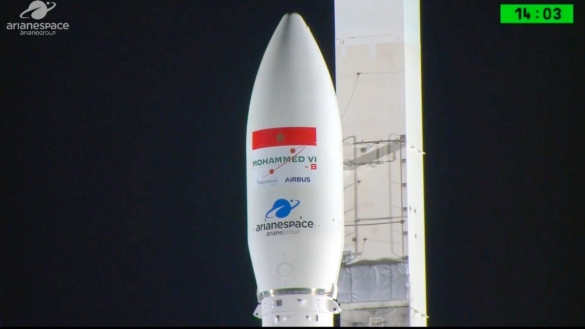
 Just one year after it launched its first satellite dubbed “MOHAMMED VI-A”, Morocco has put into orbit a second observation satellite that would complete the aerial surveillance of the Moroccan territory, mostly for civilian applications.
The second spacecraft, baptized the MOHAMMED VI-B satellite was successfully placed in sun-synchronous orbit by lightweight launcher Vega, after taking off Tuesday from the Guiana Space Center (CSG) Kourou at 01H42 GMT, said Arianespace agency.
The separation of the satellite took place as planned a little more than 55 minutes after the launcher took off.
The Mohammed VI-B satellite joins the MOHAMMED VI – A satellite, which was orbited by Arianespace on November 7, 2017.
The second MOHAMMED VI-B spacecraft is part of the space program decided by the King of Morocco in 2013. The realization of this program spreads over a five-year period. The satellites are based on the Pléiades-HR high-resolution Earth observation satellite that is jointly built by French satellite manufacturers Airbus Defence and Space – who built the satellite bus – and Thales Alenia Space – who are responsible for the payload.
With the launch of these two spacecraft at the forefront of space technology, Morocco is fostering its earth observation technology and capabilities and ensuring a wide and complete coverage of its territory and its borders.
Actually, together, the two satellites will give Morocco an edge in terms of border monitoring, mapping and land surveying activities, spatial planning, preventing and management of natural disasters, and monitoring environmental changes and desertification thanks to the high-resolution optical images they are able to take.
The geospatial information given by the satellite imagery will be used in territorial management, land use planning and the effective management of territorial economic, social and environmental resources that are at the center of the overall development process. The satellite data are strategic tools for a relevant management of the territory, because they provide a good knowledge of the available resources, in terms of repair, evolution and interaction between the different stakeholders.
According to agronomists, the use of technology and new techniques, including geospatial information derived from satellite remote sensing, is also an effective way to manage agricultural resources as well as to plan and implement strategies for efficiency and durability. Thanks to satellite imagery and its combination with information on soils, meteorological data, field observations, operators in the field of agriculture will have available information that will be of great help in risk and disaster management (drought, flood, locust risk).
Morocco has thus entered the elite club of countries having satellites into orbit and become the first country in Africa to deploy twin satellites.
